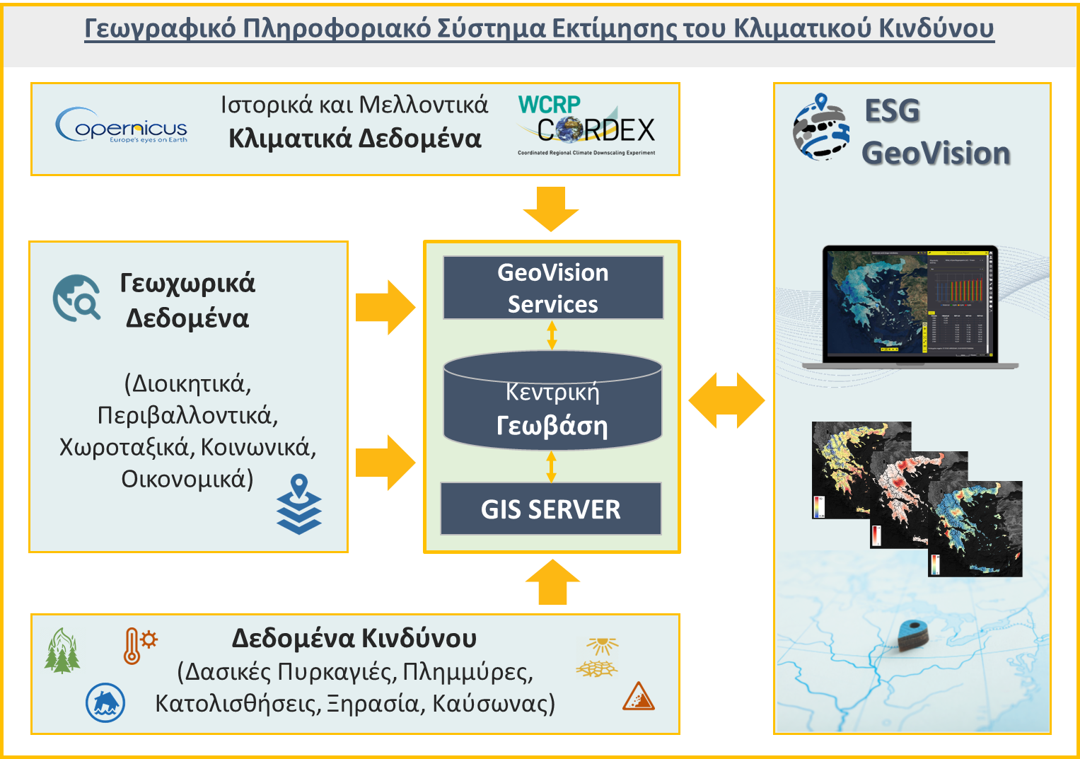
Geographic Information System for Climate Risk Assessment
Assessment of Natural Climate Hazard Risk: Forest Fires, Floods, Landslides, Drought, Heatwaves
Assessment of Natural Climate Hazard Risk: Forest Fires, Floods, Landslides, Drought, Heatwaves
The ESG GEoVision Climate Risk Assessment Geographic Information System is an interactive mapping platform designed to organize and provide access to climate and other relevant geospatial data, aiming to assess and visualize the risk posed by natural phenomena directly linked to climate change, such as wildfires, floods, landslides, drought, and heatwaves. By using the application, users can navigate through a series of dynamic online maps that consolidate data on sensitivity, exposure, and vulnerability related to these risks and examine how they are expected to evolve in the future, based on currently available climate data and scenarios.